


Species Account for Howe Lane Sand Pit
|
Maps produced by MapMate®. Data overlays Copyright © Essex Field Club 2024.
Reproduction for study and non-profit use permitted, all other rights reserved.
Missing records?
Howe Lane Sand Pit
Reproduction for study and non-profit use permitted, all other rights reserved.
No data yet available for this species in this format
View time series maps for Howe Lane Sand Pit
member log-on for taxon report
1992-on hectads: 0
Pre-1992 hectads: 0
Total hectads: 0
Images
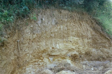
Great Sampford Howe Lane Pit (exposure near south face) in 1980

Great Sampford Howe Lane Pit (W side of N face) in 1980

Great Sampford Howe Lane Pit (north face) in 1980

upload a new image
Habitats
no broad habitat data available
no subhabitat data available
no structural habitat data available
no habitat detail or method data available
Why not join the Club, register and add a new species page
Interpretation of distribution maps